We left Parhrump, Nevada early Saturday morning and took SR-190 to enter Death Valley from the east side of the Park. Again, traffic was very light and the vistas were beautiful.
 |
| View from ZABRISKIE POINT |
Over millions of years the land has been covered in turn by inland seas and intermittent Ice Age lakes.
The lake bottoms filled with layers of gravel, mud, minerals and salts eroded from the surrounding mountains. Seismic activity further tilted and shaped the landscape.
When the waters finally evaporated they left behind mineral riches including silver, gold, copper, salt deposits and borax.
Death Valley's dramatic geologic history is readily evident in its mountain ranges, salt flats, sand dunes, alluvial fans, valley floor, and volcanic craters. In 1933 a portion of Death Valley was designated as a National Monument. The Desert Protection Act of 1994 added over a million more square acres and Death Valley became a National Park.
 |
| View from ZABRISKIE POINT |
We got out at Zabriskie Point to stretch our legs.
A short walk from the parking lot up to the overlook gives panoramic views of the Furnace Creek Badlands.
 |
| View from ZABRISKIE POINT |
 |
| FURNACE CREEK INN and 49'ers MONUMENT |
A monument near the Furnace Creek Inn, honors the 49'ers who came through Death Valley on their way to the California Gold fields.
South of Furnace Creek Inn, Badwater Road leads to Artist Drive. This one-way 9 mile paved road winds past colorful hillsides and canyons. An area called Artists Palette is particularly colorful with unusually colored rocks in shades of turquoise, red, lavender, white, green, black, orange, yellow, grey and brown. It was a scenic spot for a lunch break.
 |
| ARTISTS PALETTE, Death Valley |
 |
| Boardwalk at SALT CREEK, Death Valley |
Our next stop was Salt Creek, located off the main highway at the end of a 1-1/4 mile graded dirt road.
A raised boardwalk nature trail follows the path of the creek and helps protect the fragile area from human impact.
 |
| SALT CREEK, Death Valley |
Salt Creek is home to a small population of Desert Pupfish, tough little survivors from a time when a freshwater lake (Lake Manley) covered the area up until about 2000 years ago.
 |
| SALT CREEK, Death Valley |
As the lake dried up, the fish became isolated in pockets of water that varied in salinity and temperature. Eventually the isolated populations evolved into 10 distinctive species, each adapted to their unique environment.
 |
| DESERT PUPFISH - Cyprinodon sp. |
Two of these pupfish species are now extinct, four are endangered and one is threatened. Water availability is crucial to the continued survival of these tiny, rare and extraordinary creatures.
 |
| UBEHEBE CRATER, Death Valley |
Ubehebe Crater is located about 40 miles north of Salt Creek, on the North end of Scotty's Castle Road. It is a volcanic explosion crater, formed a mere 2000 years ago. Hot magma turned groundwater into steam, and the resulting explosion created a crater 1/2 mile wide and 500 feet deep.
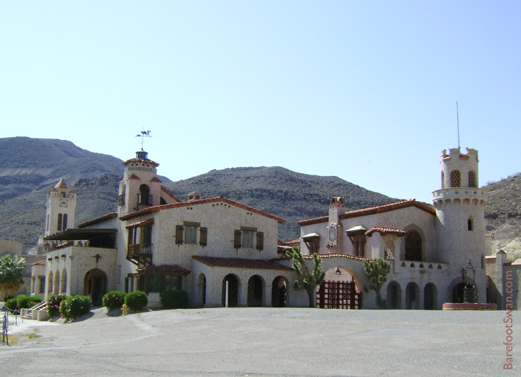 |
| SCOTTY'S CASTLE, Death Valley |
Scotty's Castle was our last stop in Death Valley. This Spanish-Moorish style mansion was built by a Chicago millionaire in the 1920's, as a winter home.
There is no charge to walk the grounds; tickets can be purchased for ranger-led tours of the buildings. Time was short so we did some birding as we enjoyed the stroll. Our bird list included Western Tanager, Yellow-rumped Warbler, Bullock's Oriole, Yellow Warbler and Common Raven.
This cactus was blooming in one of the planters near the Visitor Center.

We left Death Valley and continued driving north to Tonopah, Nevada - our viewing site for the annular eclipse the next evening.
No comments:
Post a Comment